fbpx

Tag Archive for GIS

Open Call for GIS Day Presentations and Posters

Do you use GIS in your research? Or, have you created any outstanding maps or other cartographic products? Temple University will celebrate GIS Day on Wednesday, November 16th from 12pm-6pm, and we invite members of GeoPhilly to showcase their spatial and cartographic work as a poster or brief (5-10 minute) presentation during this exciting event.  We hope to include a diverse set of presentations, from a range of GIS applications.

To participate, please submit your presentation information, including your project title and 100-word description, and indicate your preference for a poster or talk via this link by October 15, 2016.
Read more

July 8: Census Webinar (1.5 CM)


Join the Unlocking the Value of Census Data webinar on July 8, 1:00-2:30 PM to learn about census data and programs, such as the American Community Survey, the Economic Census, and Local Employment Dynamics. The session will highlight GIS and mapping resources, and demonstrate  American Factfinder (AFF) and OnTheMap.  For more information and to register:
http://planningpa.org/event/unlocking-the-value-of-census-data-1-5cm/?utm_source=Accepting+Individual+Awards+%26+Sponsors+%7C+Plus+More%21&utm_campaign=Individual+Awards%2C+Scholarships&utm_medium=email


May 4: Map It Out!


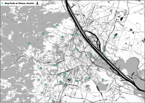
map

Philly Tech Week 2016, presented by Comcast is from April 29th to May 7th and this year the Southeast Section has planned a tech event for planners! This event offers an introduction to CartoDB, Quantum GIS, and Geoda, three open source mapping platforms. Three CM credits are anticipated. Feel free to bring your laptop and follow along with the demonstrations.

Read more

Summer of Maps Returns

Azavea’s Summer Of Maps is back – Got data? Need someone to map it? Summer of Maps is a three-month long fellowship giving student GIS analysts the opportunity to perform geospatial data analysis for local and national non-profit organizations. The deadline for non-profit project submissions is February 7, 2016. Check it out HERE.

Oct. 23: Mapping the Sustainable City

Sponsor:
Temple Libraries,
Open Data Philly,
Office of Sustainability,
greenSTEM Network,
Grounded in Philly
Location:
Paley Library Lecture Hall Room 021 (Lower Level)

Grounded in Philly, the greenSTEM Network, and Open Data Philly help Philadelphians to better understand their communities through maps and other data visualization tools. Join our panelists to discuss these projects, and learn how accessible, transparent information is a key tool of social justice, and a crucial element in creating a more sustainable city.

Read more

April 9: GeoPhilly Film Night (Free!)

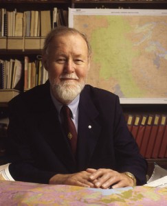
Roger Tomlinson

Roger Tomlinson

Wednesday April 9th 6:30-9:00. Film starts at 7:00 PM.

PhilaMoca 531 N 12th street, (just North of Spring Garden Street)

The GeoPhilly meetup would like to invite planners to GeoPhilly film night. This screening of short archival films related to mapping, cartography, and planning from as early as the 1940s. “Data for Decision” (1967), our feature for the evening, focuses on Roger Tomlinson (the “Father of GIS”) and the first ever use of digital analytical map making. Other films will feature WW2 era cartography, challenges of non-digital map projections and how to deter everything from boredom in suburbia to mob fights through proper planning. This event is part of Philly Tech Week. Drinks and snacks will be for sale.

Dec. 11: GeoPhilly Meetup Happy Hour

GeoPhilly is a meetup group for those interested in spatial analysis, geo-related application development and data analytics. The GeoPhilly Meetup is having a happy hour on Wednesday, December 11 from 5:00 PM to 7:30 PM after the IREG Geospatial Technology and Open Source event at DVRPC. The Happy Hour will be in the left wing of Bar Ly located at 101 N. 11th Street, Philadelphia.

Dec. 11: Geospatial Technology and Open Source event

Geospatial Technology and Open Source event

Wednesday, December 11, 2013, 10:30 AM – 5:00 PM

DVPRC, 190 N Independence Mall West, 8th FL, Philadelphia, PA 19106

The 89th meeting of the DVRPC Information Resources Exchange Group (IREG) will be a special full-day event focused on Open Source and Geospatial Technologies.

We are having presentations by those who are actively developing and providing amazing applications, tools, and data. From Web Maps to data APIs, from data visualization to GitHub, and even the cloud! We are hoping that people will walk away with a better understanding, skill, or interest in these areas. There will also be a CartoDB workshop from 4-5 following the presentation. So please come join us and be ready to learn!

This FREE event will run from 10:30 am to 5 pm and include lunch. Seating is limited to 75. Please register at: http://dvrpc.ticketleap.com/ireg/